
The Vale of Belvoir
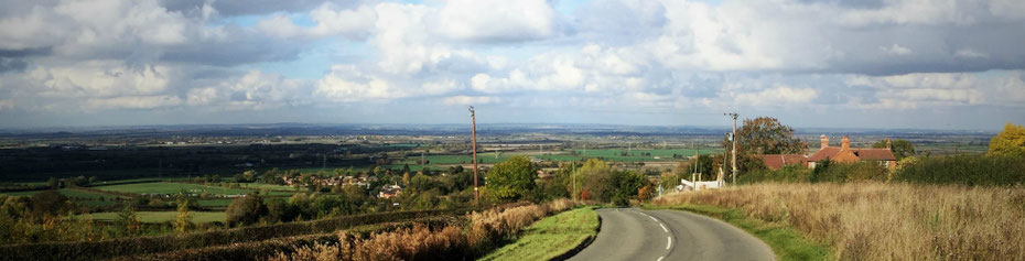
The Vale of Belvoir is a wide shallow valley, a low-lying area in south Nottinghamshire and North Leicestershire. The Vale of Belvoir is an area of fertile agricultural land which has been farmed since the New Stone Age, an area of countryside with small villages such as Langar and Barnestone which are right slap bang in the middle of the Vale.
- To the west, south and east are the low hills of the Nottinghamshire and Leicestershire Wolds with Belvoir Castle, after which the vale is named, standing prominently on the Belvoir Ridge at a height of 453 feet (138 metres) above sea level.
- To the north, the Vale of Belvoir merges into the Trent Valley.
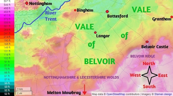
Map based on Topographic Map .com
On the map above ↑
Low lying land is shown in yellow and green; higher ground is shown in pinks and purples.
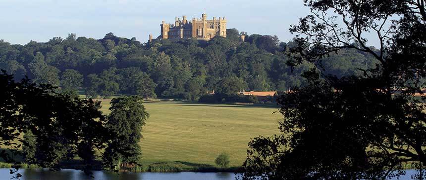
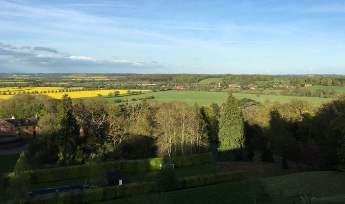
Left: Belvoir Castle seen from the Vale of Belvoir - Right: The Vale of Belvoir seen from Belvoir Castle
The villages of the Vale of Belvoir
The villages of the Vale of Belvoir are small, often with populations of less than a 1000 people; some are in Nottinghamshire, some are in Leicestershire. The largest towns are towards the north of the Vale: Bingham (population 10,000) and Bottesford (population 3,500). Almost 1000 people live in Langar-cum-Barnstone in some 400 houses.

Vale of Belvoir villages are shown in red. Map based on Maphill .com
Beyond the Vale there are larger towns:

- to the north Newark on Trent (population 30,000) has an important livestock market;
- to the south Melton Mowbray (population 27,000) also has an busy livestock market;
- Grantham is to the east (population 45,000) has an important food processing economy;
- Nottingham to the west is the largest city in the East Midlands (population 730,000) and second only to Birmingham in the Midlands.
Some villages in the Vale of Belvoir
(and towns and castles) in alphabetical order
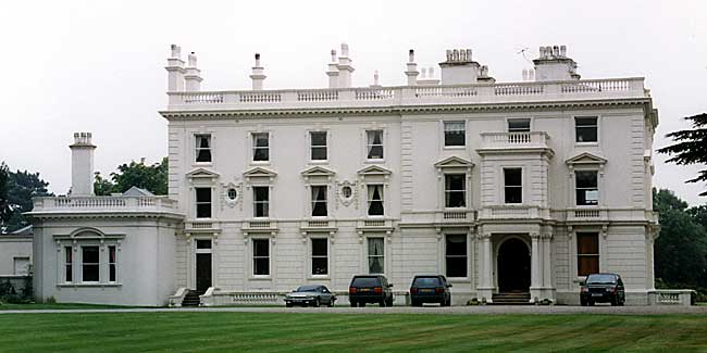
Belvoir, Leicestershire
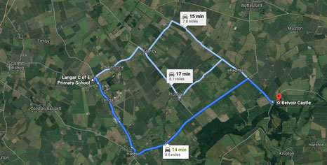
Belvoir is not the name of a village; it is the name of a castle. The name means 'beautiful view' in Norman French and it was the castle that gave its name to the Vale of Belvoir.
The name is pronounced 'beaver'.
A Norman motte and bailey castle
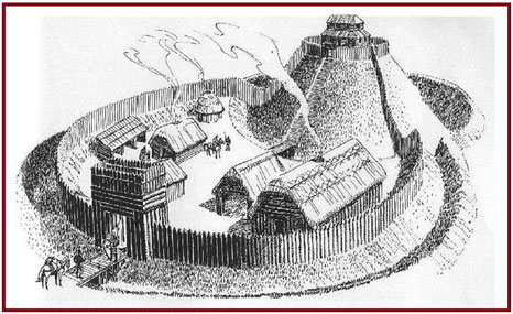
The first castle was built in 1067 by the Norman lord Robert de Todeni who was William the Conqueror’s Standard Bearer at the Battle of Hastings in 1066. (See The Normans.)
It would have looked like this drawing of a motte and bailey castle: a strong fence with a ditch surrounding the bailey.This was the area where the lord's house was with stables, store rooms and a blacksmith's. There was a mound, a motte, with a wooden watchtower on top.
This was a good position for a castle on top of the hills of the Belvoir Ridge. From here you can see for miles across the Nottinghamshire and Leicestershire countryside as far as Lincolnshire.
Four castles have stood here since 1067.
Castle No 1. First was the Norman castle built in 1067. By 1464, the Wars of the Roses had left that castle in ruins.
Castle No 2. Belvoir was rebuilt 60 years later for Sir Thomas Manners. The second castle was
a much stronger stone building with a central courtyard, some of which can be still seen. In 1649 that castle was destroyed by the Parliamentarians after Royalists had seized it during the
English Civil War.
Castle No 3. The third castle was built in 1668 as a country house rather than a
castle.
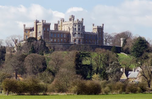
Castle No 4. The fourth castle was built between 1801-1832 for the 5th Duke and Duchess
of Rutland. It was badly damaged by fire in 1816 but rebuilt as before. That is the castle we see today.
A family of lords for a thousand years

The 11th Duke of Rutland, David Manners is a descendant Robert de Todeni who was the Norman lord the manor in 1066.
He still lives here with his family and runs the castle and its estate as a tourist attraction and business operation.
The castle and gardens are open to visitors on certain dates throughout the year: you can also go hunting, shooting and fishing and horse riding here; you can stay in the castle or in a cottage on the estate; you can visit the castle's shopping centre; you can even get married here.
↓ Click to enlarge the pictures of the inside of the castle.


Weblink
Take a tour of the castle with the Duchess of Rutland - https://www.youtube.com/watch?v=KjboDQka6BI - The link takes you out of this website to YouTube.
Bingham, Nottinghamshire
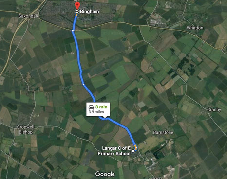
Bingham is not a village but the nearest town to Langar. To get there, follow Bingham Road!
Bingham has a population of nearly 10,000 and new houses are being built.
The town is ten times bigger than Langar and Barnstone.
There are 40 shops in the town with 20 take-aways, restaurants, pubs and cafés. Three primary schools feed Toothill secondary school. The town has a leisure centre with a swimming pool. In 2013 a survey said that Bingham was the best place to live in England!
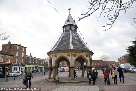
There are records of a market in Bingham from 1278, and in 1314 Edward II granted a charter to Alice de Bingham to hold a weekly town market and two fairs every year.
The weekly market was held from the Middle Ages up to the 19th century, although by 1853, White's Directory was not impressed:
"The market place is large and open, and has in the centre a very convenient butter-cross. The market, which is only of trifling importance, is held on a Thursday. The fairs for cattle, horses and swine, held on February 10th and 11th, Whit-Thursday. and November 8th and 9th, are tolerably well supplied. Hirings for servants are held on Candlemas Thursday, and on the last Thursday in October; the feast is at the November fair."
By 1888 there was no market at all. But in 1960 the market place was repaved and revitalised. There is now a Thursday market again and a farmers' market every month, though cows and sheep and pigs are no longer sold here. You have to go to Newark or Melton Mowbray if you want to buy a pig or a cow.
↓ Click to enlarge the pictures of Bingham.


↑ Click to enlarge.

Weblink: 'Children of the 20th Century' is a video that was found at Robert Miles School, Bingham while they were tidying a cupboard. The video was made in 1999 and paid for by Nottinghamshire County Council and the National Lottery Millennium Award Scheme.
Click to watch 'Children of the 20th Century on Robert Miles School's YouTube account.
These links take you out of this website.
Find more about Bingham on the town website - http://this-is-bingham.co.uk/
and an enormous amount about Bingham history on - http://www.binghamheritage.org.uk/index.php.
Colston Bassett, Nottinghamshire
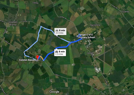
Colston Bassett is the nearest village to Langar with a population of about 400 people. There's a church, a school, a pub and a shop.
The first written record for the village appears in 1086 in the Domesday Book; Coleton/ Col's tun is Old English (Anglo-Saxon) and means Col's farm. The Bassetts were a noble family after the Norman Conquest in 1066.
↓
-
The Market Cross at the centre of village was put here in 1257 when King Henry III granted Ralph de Basset
the right to hold a weekly market. The market stopped many years ago.

-
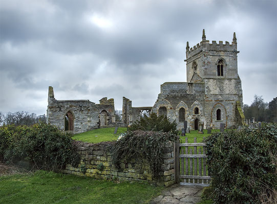
The ruins of St Mary’s church stand on a low hill a kilometre north east of Colston Bassett. It was built on the
site of an older Anglo-Saxon church.
By 1744 the church was in disrepair. - In 1892 Robert Knowles of Colston Bassett Hall built the new church of St John the Divine in the village and St Mary's was left as a ruin.
-
Colston Bassett Dairy, one of the producers of the world famous traditional Stilton cheese, was formed in 1913 as a community-based
company and uses local milk to make their Stilton cheese.
Take a look at their website - https://www.colstonbassettdairy.co.uk/ - The link takes you out of this website.
↓ Click to enlarge the pictures of Colston Bassett.


Weblink To watch a video of the Belvoir Hunt at Colston Bassett, click here. The hunt, which dates from 1750, used to hunt foxes but now follows trails. The hounds are owned by the Duke of Rutland and are kennelled at Belvoir Castle.
The link takes you out of this website.
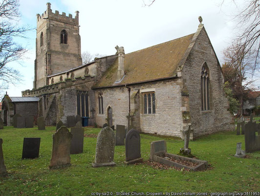
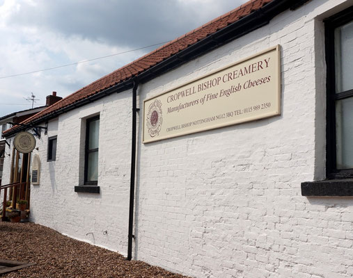
Cropwell Bishop, Nottinghamshire
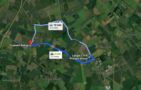
Cropwell Bishop, just 3 miles away, 10 minutes by car, is a rather bigger village than Langar or Barnstone with 700 houses and 2000 residents. There are two churches and a school, shops, pubs and a community hall.
The name is in the Domesday Book of 1086 as Crophille, Old English (Anglo-Saxon) 'cropp hyll' meaning a rounded hill.
Cropwell Bishop and Cropwell Butler were originally one manor. The hill in the name is Hoe Hill just west of Cropwell Butler, and a very small hill it is! The Anglo-Saxons used the word 'hoh' to mean a particular shape of hill; the word actually means 'heel' - a sharp hill in an otherwise flat area. This manor was the property of the Archbishop of York - hence the name Cropwell 'Bishop'.

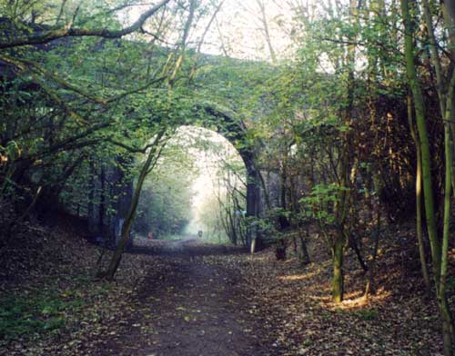
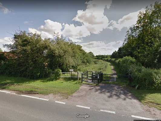
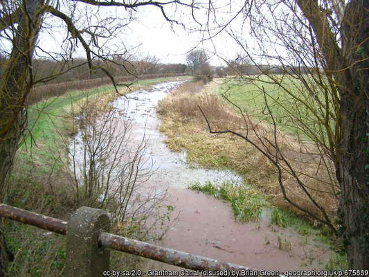
This country village has an industrial history. There were gypsum and limestone quarries and brickworks here producing materials for building. The products were shipped along the Grantham canal to Nottingham and elsewhere.
The quarries and brickworks are gone now and the canal went out of use in the 1920s and much of it is now a footpath.
- Many local houses were built from bricks made here, but a cottage on Fern Road is much older. The wooden frame was made from trees that were cut down in 1598.
- St Giles' church dates from the 13th century and has some worryingly leaning pillars and a ring of six bells.
↓ Click to enlarge the pictures of Cropwell Bishop.
Weblink
See how Cropwell Bishop's famous Stilton cheese is made in this YouTube video.
The link takes you out of this website.
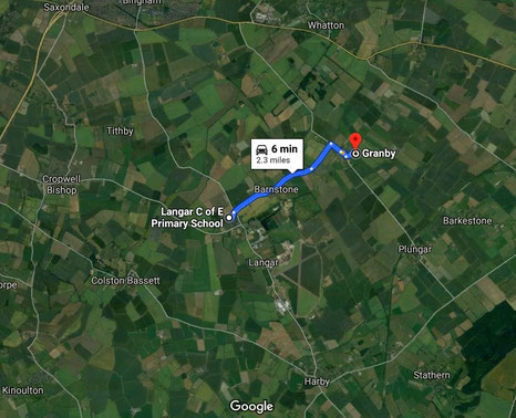
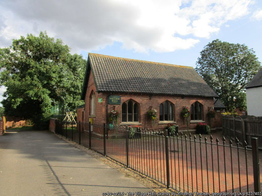
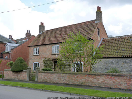
Granby, Nottinghamshire
Granby is the nearest village to Barnstone and has a population of about 400. In 2016 Granby won the Best Kept Small Village competition organised by the Campaign to Protect Rural England.
Granby is a Viking placename. It was 'Grani's by' meaning Grani's farm or village. Grani was a male Norse name and 'by' is the Viking word for a 'farm'. There were Vikings here!
● There is a 12th-century church, All Saints which has a ring of 6 bells.
● There is no longer a school here; the building is now used as the village hall.
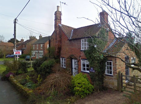
● The Old Post House dates from 1796 and was the post office and shop, now closed.
↓ Click to enlarge the pictures of Granby.

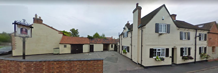
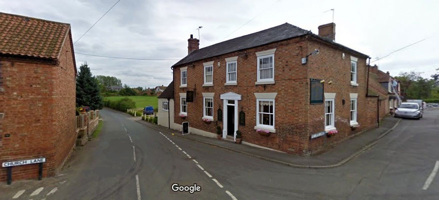
● The pub, The Marquis of Granby is one of many pubs across the country named after John Manners 1721-1770, son of the Duke of Rutland of Belvoir Castle, lord of the manor of Granby. John Manners was a famous commander of the British army during the Seven Years War (1756-1763).
Harby, Leicestershire

More Vikings! Harby is either 'Herrothr's farm' or perhaps, 'herd farm' in Old Norse - were sheep or cows kept here? There were certainly Vikings here a thousand years ago. 800 people live in Harby now.
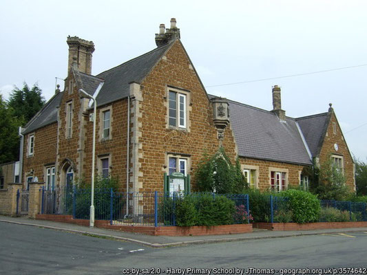
The village has a church, a primary school, a pub and a service station and a shop. There is a village hall with a sports field. The village has a lot of Victorian housing but a lot of houses were built in the later 20th century. There are two allotment sites for keen gardeners.
● The parish church is dedicated to St Mary the Virgin. There is evidence that the earliest church here was made of wood. In the 13th century the stone tower was built and the wooden nave and chancel were rebuilt in stone. The church was extensively restored in Victorian times.
● The Grantham Canal was dug in 1797 to carry coal from the Nottinghamshire coalmines to Grantham.
The canals could not compete with the railways and it was closed to boat traffic in 1929. The wharf at Harby was used to ship grain and flour to and from the village windmill in Colston
Lane.
A group of enthusiasts is restoring the canal with the hope of running boats from Grantham to the River Trent once more. The central part of the canal stretches for 5 miles from Harby eastwards
through Plungar and Barkestone-le-Vale to Redmile and has been designated a Site of Special Scientific Interest (SSSI) where many species of wildlife can be seen. (See Canals for more.)

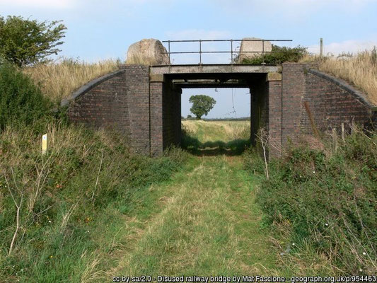
● Harby & Stathern railway station was half-way between the villages of Harby and Stathern on the Great Northern (GNR) and London & North Western Joint Railway (LNWR).
This was a locomotive exchange station for goods traffic, with GNR steam engines working to the north and LNWR engines working to the south. It was a difficult station to manage and run. Although there was a large goods yard, there were not enough sidings for goods trains.
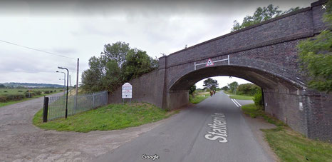
The station was not convenient for passengers either. The approach road was a mile from Harby and then a half a mile from the road to the station. The station opened in 1879 with trains from Leicester to Grantham and from Northampton. There was only one train a day stopping here by 1910 and none at all by 1922. The railway line closed in 1962 and the station and goods yards are now an industrial estate.
(See also Railways.)
↓ Click to enlarge the pictures of Harby.


Weblink
Click to hear ringing on the five bells at Harby church. The oldest bell was made in 1610 during the reign of King James I.
This link takes you to YouTube and out of this website.
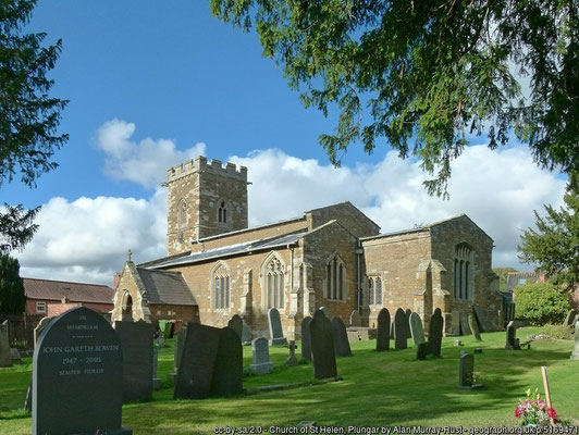
Plungar, Leicestershire
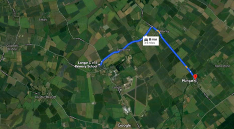
The name of this small village, Plungar is Anglo-Saxon, 'plume gara' meaning plum-tree gore. A gore was a triangular plot of land shaped like the head of a spear. The name is like that of Langar which means 'long gore.
The population is about 400 people, about the same size as Barnstone. Most houses here were built in the 19th century (Victorian times) but a some were built in the later 20th century. There is a church and a pub here but no school.
● St Helen's is a medieval church dating from the early 13th century. The tower was added in the 14th century and the rest of the church was rebuilt in the 15th century.
If you look carefully inside, the tower arch is decorated with medieval animal carvings. There are two bells from 1747.
There was a small Sunday school here; it has gone now but you can still see where it was on Church Lane next to St Helen's church. Day school children went to school at Barkestone one mile away. The nearest primary school is now at Redmile, two miles away.
● The Anchor pub was opened to serve the workers on the canal. It was originally a row of four 18th-century houses converted into a pub.
The Grantham Canal and the Great Northern and London & North Western Joint Railway run alongside each other at Plungar, though neither of them had a stopping place here.
● The canal was dug to carry coal from the Nottinghamshire coalmines to Grantham and opened in 1797. There were no wharfs at Plungar, but boats may have stopped to load and unload goods here. Rail travel took over from canals and there was no traffic on Grantham Canal by 1930. (See Canals for more.) A group of enthusiasts is restoring the canal with the hope of running boats from Grantham to the River Trent once more.
● The railway ran from Melton Mowbray to Bottesford and opened in 1879. There was no station here but there was a station near Redmile and another between Harby & Stathern. Services stopped in the 1950s and the line was closed about 1960. (Click for more on Railways.)
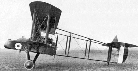
● RAF Plungar was small airfield with a grass landing strip north of the canal which opened during the First World War.
FE2b fighters of No 38 Squadron used Plungar as a Home Defence landing ground during World War I until they moved to France in 1918.
RAF Plungar was then used by No 90 Squadron whose Avro 504K fighters remained in service after the end of the First World War. There is no sign of the airfield now.
↓ Click to enlarge the pictures of Plungar.
OIL!
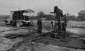
The first oil in this country was found in the East Midlands before the Second World War. In 1953 the Plungar oilfield was discovered and 32 wells were drilled producing 310,000 barrels of oil before the field was abandoned in 1965. One well was left at Plungar which had produced 220,000 barrels when it closed in 1980.
Weblink
Click to watch a news film from 1954 about drilling for oil in Plungar in 1954.
This link takes you to YouTube and out of this website.
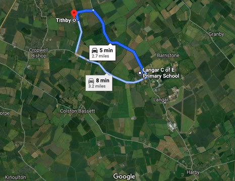
Tithby, Nottinghamshire
Tithby is a very small village with about 100 residents. The name is Viking: 'Tidhe's by' meaning Tidhe's farm or village. The name of the village used to be said as 'Tidby'. The church here is Holy Trinity and the name of its parish is spelled as Tythby.
There are only some 20 houses here, some of them farms and most built during the 19th century (Victorian).
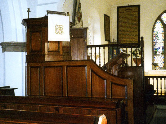
The church of Holy Trinity is medieval. Built in stone, it dates from the 13th century, though there was probably a church here before that. There are two bells made in 1662 in the brick tower. The inside of the churchhas box pews and a high wooden pulpit from the 18th century (Georgian times). Very few like this still survive as most were taken out in the 19th century.


↑ Click to enlarge pictures of Holy Trinity church, Tythby. ↓ Click to enlarge pictures of Tithby village.


