
The Stuarts and the Civil War
1603 - 1714 - largely the 1600s (17th century)
START: When Elizabeth I died childless in 1603, her 3rd cousin King James VI of Scotland became King James I of England.
END: The first part of the Stuart period ended in 1649 when King Charles I was executed.
START: 1649 - During the Commonwealth, England was ruled by Parliament with no king.
END: 1659 - After a period of civil war, the son of Charles I was invited back to be king.
START AGAIN: 1659 - The Restoration of the Monarchy under Charles II.
END: The last of the Stuart family to reign was Queen Anne who died with no surviving children in 1714.
Monarchs of the Stuart family with the dates they reigned
Monarchs
James I 1602 - 1625
Charles I 1625 - 1649

The Commonwealth
(No monarch)
Council of State 1649 - 1653
Lord Protectors -
Oliver Cromwell 1653 -1658
Richard Cromwell 1658 - 1659

Monarchs
Charles II 1660 - 1685
James II 1685 - 1668
William III 1669 - 1694
Mary II 1669 - 1702
Anne 1702 - 1714

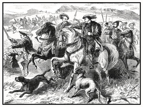
For the English Civil War see Lords of the Manor in Stuart times and Wiverton Hall.
Langar and Barnstone have always been about farming.
Big changes on the farm - ENCLOSURES
We're in the time of the Stuarts but first
let's start with the Middle Ages . . .

The Middle Ages
Open field farming
← The picture shows an imaginary medieval village surrounded by three large open fields divided into strips.
It's not, but it could be Langar.
The fields of Langar and Barnstone were Town Field, Middle Field and North Field.
In the Middle Ages people rented strips of land in each field from the lord of the manor to grow their crops. Everyone had a share of better and poorer land. Some people had lots of strips, some had a few and other people had no land and worked for other people.
Crop rotation: Everyone had to plant the same crops: barley, oats or beans in one field, wheat or rye in another while the third field was left to rest (fallow) with the livestock grazing on it. The system worked well for hundreds of years. The crops were planted in different fields each year.
For much more information on open field farming, see The Middle Ages.
Moving on to Tudor times:
Early Enclosures - Deer parks
In the 16th century some wealthy lords began to enclose the open fields and common land to create hunting parks around their houses.
Sometimes they removed whole villages to create their parks and sent the villagers away with nowhere to go.
People made homeless
In 1517 Henry VIII's government investigated these enclosures. In our area they found that lords had enclosed land at Whatton, Aslockton and Car Colston. There were complaints from 56 parishes in Nottinghamshire.
The worst case was at Wiverton in 1510, where Sir George Chaworth removed the whole village from around his hall. He created a deer park of 120 acres on land that had been shared as common pasture for the villagers to graze their livestock. Four families (26 people) were sent away with nowhere to go.

At last - the Stuarts:
The problem was . . .
In the 17th century the problem for lords of the manor was not creating deer parks. Deer parks were expensive to run - and they were not fashionable any more. Landowners looked for ways to make money from their land.
Two problems:
1. The lord's land was scattered in strips across the open fields like everyone else's land.
2. The lord of the manor had to plant his fields with the same crops as everyone else.
This meant:

1. The lord's workers spent a lot of time walking from one strip to another across the large open fields. This was very inefficient. Lords wanted all their strips in one place.
2. If wheat brought a good price at Bingham market, you couldn't plant wheat if everyone was growing rye. If cows sold for a good price at Bingham market, you couldn't keep more cows, because there was nowhere to put them.
New ideas
By the 17th century, there were new ideas in farming which were impossible to try in the open field system -
- Wealthy landowners wanted to keep more cattle or sheep - but you need fields with fences or hedges to do that.
- They wanted to grow more wheat - it gave bigger crops and sold at a higher price.
- They wanted to grow clover to put nitrogen in the soil to fertilise the next crop.
- They wanted to grow turnips in the fallow field - turnips kept weeds down and could be fed to the animals.
But they could not try these ideas in open fields where everyone grew the same crops.
The solution → ENCLOSURES

Enclosing the land meant sharing it all out between all the people who farmed the strips and then putting fences or hedges round the new fields. In this way everyone's land was in one place and not scattered across the open fields. The common land, that everyone used, was also divided up and fenced off.
This was sometimes agreed by all the landowners and tenants in a parish.
But often it was agreed by the wealthy landowners and the poorer farmers had little choice.
Enclosures - how it's done

- Draw a map of the whole manor.
- Measure the fields and all the strips - there are thousands.
- Find out who they all belong to.

Enclosures - how it's done
- Add up the total area of everyone's strips in the different fields. The length of a strip was a furlong (220 yards = about 20 metres) and 11 yards wide, so the area was 2420 square yards.
-
Draw a plan of the new fields with new roads in between.
- Go out and mark the new fields with posts.
- Put fences or hedges and ditches round the new fields.
-
Take your wages - you've earned them! The job has taken three years.
Enclosures?

A good idea - say the landowners.
The landowners at Moorhouse in Nottinghamshire explained why enclosures were a good idea:
'The advantages will be great for the quantity of land.
The Commons are undrained, covered with Thistles and of little value. The Arable land is in scattered pieces in the several open Fields. Livestock is
Farmed to great disadvantage.
The improvement both to the Open and inclosed land will lead to profitable employment for Labourers and increase the value of the land.'
The landowners thought it was well worth paying for the survey and for new fences, hedges, ditches and roads. The enclosure of Moorhouse in 1860 cost £1,427 2s 5d - in today's money that's tens of thousands of pounds. But after enclosure, landlords could grow more crops and breed more cattle, and they could charge higher rents to their tenants.

But the solution was a problem.
(This example of problems caused by enclosures is Victorian, later than the Stuart period, but the problems were the same.)
The solution was a problem for poorer people.
In 1865 an Act was passed in Parliament for eight wealthy landowners at Selston, Nottinghamshire. The landowners said that the land could be put to better use. The Act of Parliament allowed them enclose the wasteland and the common land.
But in 1877 when the landowners put fences on the common land, there was trouble. A crowd of 5000 people came to protest meetings.
The protesters said that, in the past, everyone had always put a horse or cow, sheep or geese on the common land. Now there was nowhere to keep their animals. There were three days of rioting. Six miles of fencing was torn up, hedges were burned and crops were stolen. The damage cost £1500. 26 people were arrested and 17 people were found guilty.
And, of course, despite the riots, the enclosures happened anyway. (These were the last in Nottinghamshire - all of the open fields and commons in the county were enclosed now.)

Langar and Barnstone enclosed
The open fields and common land of Langar and Barnstone were enclosed in 1681 by lord of the manor, Scrope Howe, 1st Viscount Howe. (He owned half the county of Nottinghamshire.)
This is earlier than most enclosures around here which happened in the 1700s (18th century).
In the Vale of Belvoir some parishes were enclosed in Tudor and Stuart times, but most were enclosed by Parliamentary Acts after 1780. Parishes with enclosed fields included Aslockton in 1780, Cropwell Butler in 1787, Whatton in 1789 and Granby in 1793.

Glebe lands
Some fields were given to the Rector of Langar cum Barnstone so that the villagers would no longer have to pay the tithe, one tenth of their earnings paid to the church. This saved the villagers a lot of money.
These fields (glebe lands) were on Harby Road near the entrance to Langar Airfield; more fields were on Harby Lane near Langar Grange. There are two fields which still belong to the church:
- Parson’s Close near Bottom House Farm on Cropwell Road and
- Barnstone Close at the rear of The Walnuts on Main Road in Barnstone.

The patchwork quilt of England
People describe the landscape of England as a 'patchwork quilt'. Quilts are bed covers. Patchwork quilts have been made for hundreds of years from pieces of left-over material. This is what the enclosed, hedged fields of the English countryside look like.

Click here to go to Google maps. See for yourself
the patchwork quilt of Langar and Barnstone.
The link takes you out of this website.

Look over a hedge in our area and you will see the pattern of fields and hedges that was laid out in the 17th century - it's the patchwork quilt of Langar and Barnstone.
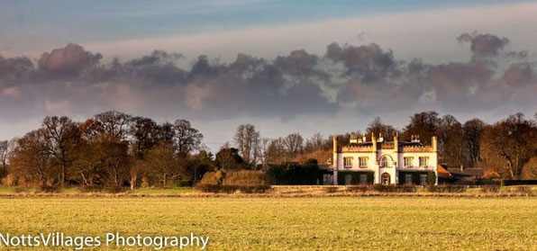
The picture below looks north on Main Road between Langar (left) and Barnstone (right).


Celia Fiennes
was a remarkable woman who travelled about England in the 1690s and wrote a diary of what she saw: 'Through England on a Side Saddle'.
Standing on the hill at Nottingham Castle, she described the view across to the Vale of Belvoir:
At a distance we see Beavior Castle the Earle of Rutland's house, and a prospect more than 20 mile about, shewing the diversityes of Cultivation and produce of the Earth. The land is very Rich and fruitfull, so the Green Meadows wth the fine Corrn ffields wch seemes to bring forth in handfulls. They soe most of Barley and have great Encrease, there is all sorts of Graine besides, and plaines and Rivers and Great woods and Little towns all in view.
Sherington - open fields enclosed
No maps survive of the medieval open fields or the 17th-century enclosures at Langar and Barnstone. But they do at Sherington, a small village in Buckinghamshire. The maps below were drawn by members of Sherington local history society who researched the history of their area.
In 1580
there were three very large open fields: Marehill Field, Middle Field and Windmill Field. These were divided into thousands of strips. The strips are shown grouped in blocks known as furlongs - there could be 100 strips in a furlong. People farmed strips all over the open fields.
In 1796
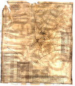
the main landowners in Sherington had an Act passed in Parliament to have the open fields enclosed. The land was then shared out among all the owners.

Has it changed?
Compare the 1796 map of Sherington → with the 2015 map to see if the fields have changed.
Click the map to enlarge it.

Weblinks

The effects of Enclosures on the peasants of England
You need to concentrate as Christina Croft explains a complicated subject in just 6 minutes! YouTube video.
The link takes you out of this website.

Enclosure riots - breaking the fences
A short clip from the film, 'Cromwell' (1970) showing fences being put up and broken down. YouTube video.
The link takes you out of this website.